Where will city sidewalk funding make the biggest impact? Pedestrian demand or “walk potential” is a metric that can help improve transportation equity and make your city or development project work better for everyone. In other words, walk potential identifies where there are useful locations within walking distance of other locations, like a grocery store near a residential area.
To help cities answer this question and conduct deeper analysis, I created the Walk Potential spatial analysis metric.
How is Walk Potential used?
Walk potential analysis is a useful metric for assessing equity and safety priorities are being met in infrastructure planning initiatives.
Using OpenStreetMap, you can calculate the percentage of twenty categories of amenities within a 10-minute walk across the city. The result is a heatmap and underlying spatial data that planners can use in more complex calculations to inform policy-making. For one thing, a city planner can identify locations that could potentially be walkable for residents, but where suitable infrastructure is missing.
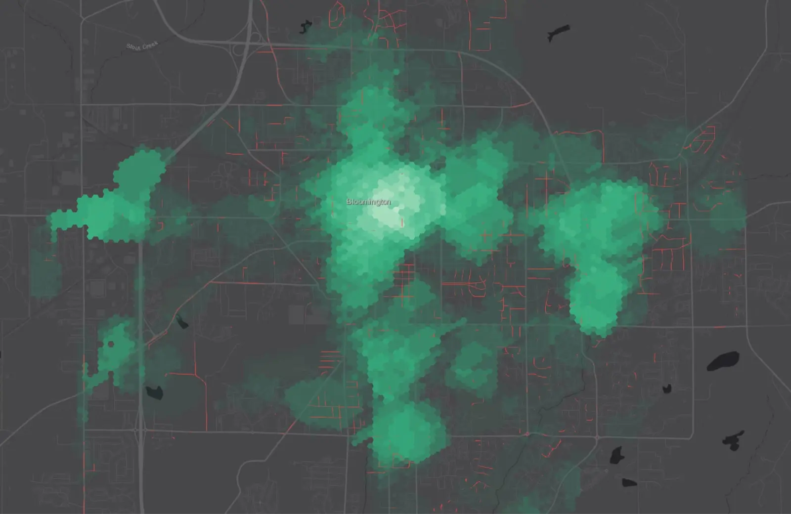
The image above is an example of this in action in Bloomington, Indiana. It shows a heatmap of Walk Potential in green contrasted with “missing” sidewalks highlighted in red. The interactive map provides planners with a comprehensive view of where sidewalks are missing compared to places with destinations nearby to walk to. Understanding this helps city officials identify which sidewalk projects would create the most access for residents.
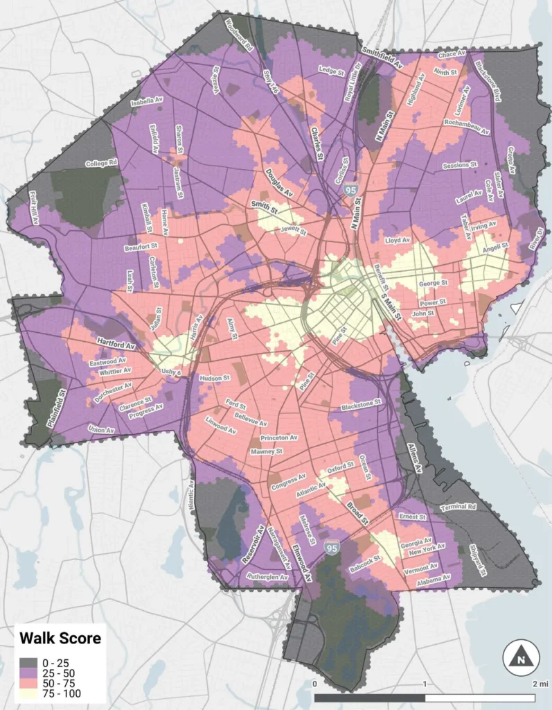
Maps like these are also a great way to communicate with elected officials and the public. Alex Ellis, a planner from Providence, Rhode Island, recently adapted the methodology and included the map as part of the city’s 2025 Safe Streets Plan to implement Vision Zero.
Try it yourself!
You can read more about Walk Potential and how to calculate it for your city or project on my blog, or download the code to try it yourself. The code is currently written using Node.js, which is part of the tech stack here at RideAmigos. I may make a future version available as a plugin for GIS software to improve accessibility to planners everywhere.
If you’re looking for ways to encourage residents to use your pedestrian and bike infrastructure, CommuteHub from RideAmigos can help. Talk to our experts about your transportation demand management programs and get a demo of how it can work for you.